Wednesday, April 24, 2024
Open today 4 PM - 11 PM
Wednesday, April 24, 2024
Open today 4 PM - 11 PM

Digital Exhibitions
The Land Divided, The World United
Building the Panama Canal
Interactive Map
For centuries, the narrow Isthmus of Panama seemed an ideal place to connect the Atlantic and Pacific Oceans. A French attempt at a ship canal in the late 19th century succumbed to tropical disease and financial problems. The U.S. took over the monumental challenge in 1904, opening the 50-mile-long Panama Canal 10 years later on August 15, 1914. In the 100 years since, more than 1,000,000 ships have passed through the Panama Canal.

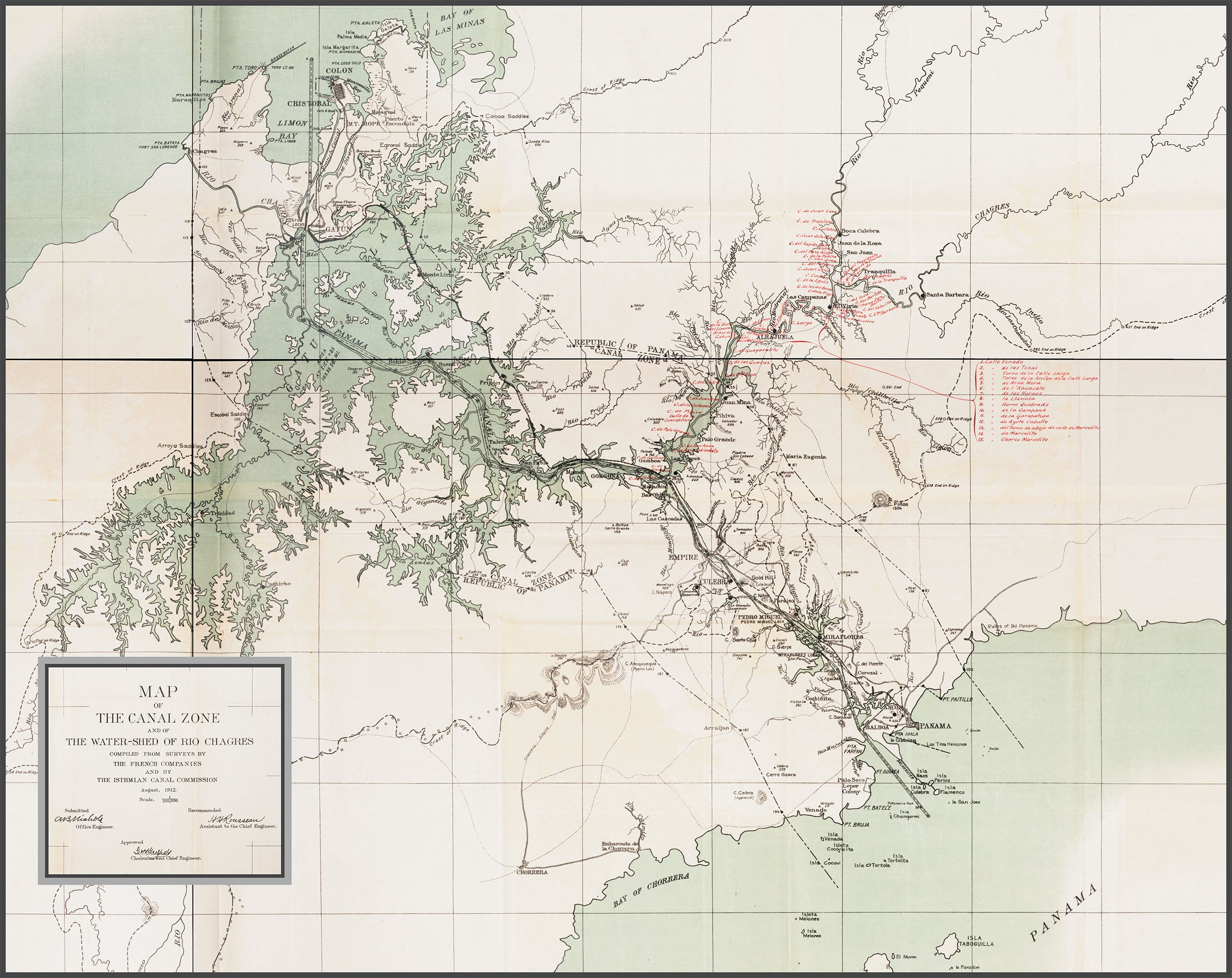
Map source: Annual Report of the Isthmian Canal Commission for the Year Ending. Washington: G.P.O., Maps and Diagrams, 1912, plate 96.